/ Mar 28, 2026
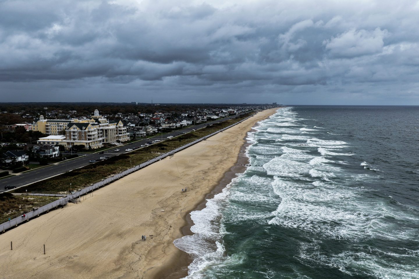
The term Nor’easter evokes images of howling winds, pounding waves and deep snow drifts along the U.S. East Coast. These powerful storms often dominate winter weather headlines, disrupt travel, close schools and make coastal communities hold their breath. In this article we will explore what a nor’easter is, how and why they form, what kinds of impacts they bring, and how to be prepared when one is on its way. The tone is friendly yet professional—think of a knowledgeable meteorology-buff guiding you through the details step by step.
In its simplest form, a nor’easter is a large-scale storm system (an extratropical cyclone) that develops along the eastern coast of North America and is particularly known for strong winds that blow from the northeast.
The name “nor’easter” comes from the direction of the prevailing winds over the coastal area during the storm—the winds typically blow from the northeast onto the land.
These storms usually form close to the East Coast, usually between Georgia and New Jersey (or the Mid-Atlantic region) and within about 100 miles (≈160 km) east or west of the coastline. National Weather Service+1
Although often associated with heavy snow and blizzards, a nor’easter does not always mean snow — the key is the storm’s dynamics and wind from the northeast, plus precipitation (rain or snow) and often coastal effects. The Weather Channel+1
While storms like hurricanes or tropical cyclones get most of the public attention, nor’easters have their own distinct character:
Hurricanes form over warm tropical waters and are fueled by latent heat from the ocean, while nor’easters are extratropical and often draw energy from the clash of cold air over land and warm moist air over the ocean.
Nor’easters move up the coast (generally northeastward) and often intensify as they travel along the shoreline or just offshore. The Weather Channel+1
The formation of a nor’easter is a fascinating interplay of atmospheric dynamics, ocean temperature contrasts and geography. Let’s walk through the process.
Cold, dry air from the north or northwest — often Arctic or polar air masses that spill southward across Canada and the U.S. interior. Almanac
Warm, moist air from the Atlantic Ocean (often near the Gulf Stream) — the relatively warm water along the East Coast provides moisture and heat that fuel the storm. Encyclopedia Britannica
A low-pressure system that develops or moves into the region — the system often develops just off the coast or over the coastal waters and then sometimes moves northeast. The Weather Channel+1
A favourable jet stream or upper-level trough — this helps create lift and intensification of the low-pressure system. National Weather Service

Here is a step-by-step story of how a typical nor’easter might develop:
Cold air plunges southward across the landmass.
Meanwhile, warm ocean waters off the East Coast supply moisture and heat.
A low-pressure system—or an existing one—moves into or develops near the coast.
The interaction of cold air, warm moist air and dynamic upper-level features causes rapid intensification. The storm’s winds, which circulate counter-clockwise in the Northern Hemisphere, end up bringing strong northeasterly winds at the coast. National Geographic Education
The storm often tracks northeastward, sometimes along the coast or just offshore. As it moves, it can bring heavy precipitation, strong winds, rough seas and coastal flooding.
Nor’easters can occur at any time of year, but they tend to be most frequent and most intense during the cooler months—generally from September through April, with peaks in winter. The Weather Channel+1 The reason: the contrast between cold land air and relatively warm ocean water is greatest in winter, which fuels these storms more strongly.
Nor’easters are more than just heavy snow or rainy days—these storms can have wide-ranging impacts across many sectors.
Depending on temperature profiles and the storm track, a nor’easter can bring:
Large accumulations of snow across the Northeast.
Heavy rainfall, especially in coastal and southern areas of the track. Almanac
A combination of snow, sleet or freezing rain in transitional zones.
Gusts of gale force are common, and in intense storms, winds may reach hurricane-force levels. Encyclopedia Britannica
The wind and wave action can cause coastal erosion, damage to infrastructure and flooding of low-lying areas. National Weather Service
Rough seas and large surf threaten mariners and coastal communities.
Snow, ice or flooding can shut down roads, rail, air travel and shipping.
Power outages are frequent when wind, snow and falling trees combine.
Coastal towns may face evacuations or damage from storm surge.
Some nor’easters have caused billions of dollars in damage. National Weather Service They affect large population centres along the East Coast (e.g., the I-95 corridor from Washington D.C. through Philadelphia and New York to Boston) which increases the potential for disruption.
Storms that fall into the nor’easter category include:
The “Blizzard of 1888” – a historical example often cited. Almanac
The March 1993 “Superstorm” (also called “Storm of the Century”) – a dramatic and widespread event. National Geographic Education
Meteorologists recognise that not all nor’easters develop exactly the same. Here are a couple of classification points.
According to meteorological studies (such as those summarised by educational sources), there are two common development pathways:
Miller Type A: A low pressure develops near the Gulf Coast or East Coast and moves northeastward up the coast. National Geographic Education
Miller Type B: A low forms inland (for example in the Midwest), moves east, then re-develops along the coast and tracks northeast. National Geographic Education
While winter remains the peak season, nor’easters can—and sometimes do—form outside the usual timeframe. For instance, there have been rare May nor’easters. AP News Recognising these variations matters for preparedness.
If you live along the East Coast—or plan to travel or stay there during seasons when nor’easters are common—preparation is key. Here are practical tips.
Monitor weather forecasts and warnings from reliable sources such as the National Weather Service (NWS). National Weather Service
Prepare an emergency kit: three days of food, water, medications and supplies in case power and roads are disrupted. National Weather Service
Check your home for vulnerabilities: make sure gutters are clear, snow-load risks (for heavy snow storms) are mitigated, and trees near power lines are trimmed.
Plan your travel: avoid driving in heavy snow or coastal flooding; public transit may be impacted.
Stay indoors if a warning is issued, avoid unnecessary travel.
Beware of coastal flooding: stay away from beach and shoreline during high surf and storm surge.
If you must drive, watch for icy patches, drifting snow and changing conditions.
Be prepared for power outages—have flashlights, chargers and alternate heating/cooking options ready.
Stay off roads until they are cleared and declared safe.
Report downed power lines and avoid touching any wires or cables that may be live.
Check in with neighbours and help vulnerable community members if safe to do so.
Document damage for insurance purposes if your home or property was affected.
Emerging research suggests that the strongest nor’easters are becoming more destructive—an important consideration for the future of coastal resilience and infrastructure planning.
Specifically:
Some studies indicate a roughly 20% increase in the destructive potential of the top percentile of nor’easters over the last 80 years. Live Science
The warmer ocean waters and increased atmospheric moisture associated with climate change may serve to fuel more intense storms.
While total frequency of nor’easters may not rise significantly, the severity of the most extreme events is a growing concern.
Understanding this trend underscores the importance not only of personal preparedness but also of investment in resilient infrastructure in regions prone to nor’easters.
A nor’easter is a distinct type of storm that develops along the U.S. East Coast, bringing strong northeasterly winds, heavy precipitation (rain or snow), and often significant coastal effects.
The main ingredients are cold land air, warm moist ocean air and a low-pressure system that intensifies near the coast.
They are most common in the cooler months (September-April) but can occur outside that timeframe.
Impacts are broad: snow, rain, wind, coastal flooding, travel disruption, power outages and economic cost.
Being prepared—both individually and at community/infrastructure levels—is key to minimizing harm.
In the age of climate change, the most extreme nor’easters may become more destructive, so awareness and resilience matter more than ever.
The term Nor’easter evokes images of howling winds, pounding waves and deep snow drifts along the U.S. East Coast. These powerful storms often dominate winter weather headlines, disrupt travel, close schools and make coastal communities hold their breath. In this article we will explore what a nor’easter is, how and why they form, what kinds of impacts they bring, and how to be prepared when one is on its way. The tone is friendly yet professional—think of a knowledgeable meteorology-buff guiding you through the details step by step.
In its simplest form, a nor’easter is a large-scale storm system (an extratropical cyclone) that develops along the eastern coast of North America and is particularly known for strong winds that blow from the northeast.
The name “nor’easter” comes from the direction of the prevailing winds over the coastal area during the storm—the winds typically blow from the northeast onto the land.
These storms usually form close to the East Coast, usually between Georgia and New Jersey (or the Mid-Atlantic region) and within about 100 miles (≈160 km) east or west of the coastline. National Weather Service+1
Although often associated with heavy snow and blizzards, a nor’easter does not always mean snow — the key is the storm’s dynamics and wind from the northeast, plus precipitation (rain or snow) and often coastal effects. The Weather Channel+1
While storms like hurricanes or tropical cyclones get most of the public attention, nor’easters have their own distinct character:
Hurricanes form over warm tropical waters and are fueled by latent heat from the ocean, while nor’easters are extratropical and often draw energy from the clash of cold air over land and warm moist air over the ocean.
Nor’easters move up the coast (generally northeastward) and often intensify as they travel along the shoreline or just offshore. The Weather Channel+1
The formation of a nor’easter is a fascinating interplay of atmospheric dynamics, ocean temperature contrasts and geography. Let’s walk through the process.
Cold, dry air from the north or northwest — often Arctic or polar air masses that spill southward across Canada and the U.S. interior. Almanac
Warm, moist air from the Atlantic Ocean (often near the Gulf Stream) — the relatively warm water along the East Coast provides moisture and heat that fuel the storm. Encyclopedia Britannica
A low-pressure system that develops or moves into the region — the system often develops just off the coast or over the coastal waters and then sometimes moves northeast. The Weather Channel+1
A favourable jet stream or upper-level trough — this helps create lift and intensification of the low-pressure system. National Weather Service
Here is a step-by-step story of how a typical nor’easter might develop:
Cold air plunges southward across the landmass.
Meanwhile, warm ocean waters off the East Coast supply moisture and heat.
A low-pressure system—or an existing one—moves into or develops near the coast.
The interaction of cold air, warm moist air and dynamic upper-level features causes rapid intensification. The storm’s winds, which circulate counter-clockwise in the Northern Hemisphere, end up bringing strong northeasterly winds at the coast. National Geographic Education
The storm often tracks northeastward, sometimes along the coast or just offshore. As it moves, it can bring heavy precipitation, strong winds, rough seas and coastal flooding.
Nor’easters can occur at any time of year, but they tend to be most frequent and most intense during the cooler months—generally from September through April, with peaks in winter. The Weather Channel+1 The reason: the contrast between cold land air and relatively warm ocean water is greatest in winter, which fuels these storms more strongly.
Nor’easters are more than just heavy snow or rainy days—these storms can have wide-ranging impacts across many sectors.
Depending on temperature profiles and the storm track, a nor’easter can bring:
Large accumulations of snow across the Northeast.
Heavy rainfall, especially in coastal and southern areas of the track. Almanac
A combination of snow, sleet or freezing rain in transitional zones.
Gusts of gale force are common, and in intense storms, winds may reach hurricane-force levels. Encyclopedia Britannica
The wind and wave action can cause coastal erosion, damage to infrastructure and flooding of low-lying areas. National Weather Service
Rough seas and large surf threaten mariners and coastal communities.
Snow, ice or flooding can shut down roads, rail, air travel and shipping.
Power outages are frequent when wind, snow and falling trees combine.
Coastal towns may face evacuations or damage from storm surge.
Some nor’easters have caused billions of dollars in damage. National Weather Service They affect large population centres along the East Coast (e.g., the I-95 corridor from Washington D.C. through Philadelphia and New York to Boston) which increases the potential for disruption.
Storms that fall into the nor’easter category include:
The “Blizzard of 1888” – a historical example often cited. Almanac
The March 1993 “Superstorm” (also called “Storm of the Century”) – a dramatic and widespread event. National Geographic Education
Meteorologists recognise that not all nor’easters develop exactly the same. Here are a couple of classification points.
According to meteorological studies (such as those summarised by educational sources), there are two common development pathways:
Miller Type A: A low pressure develops near the Gulf Coast or East Coast and moves northeastward up the coast. National Geographic Education
Miller Type B: A low forms inland (for example in the Midwest), moves east, then re-develops along the coast and tracks northeast. National Geographic Education
While winter remains the peak season, nor’easters can—and sometimes do—form outside the usual timeframe. For instance, there have been rare May nor’easters. AP News Recognising these variations matters for preparedness.
If you live along the East Coast—or plan to travel or stay there during seasons when nor’easters are common—preparation is key. Here are practical tips.
Monitor weather forecasts and warnings from reliable sources such as the National Weather Service (NWS). National Weather Service
Prepare an emergency kit: three days of food, water, medications and supplies in case power and roads are disrupted. National Weather Service
Check your home for vulnerabilities: make sure gutters are clear, snow-load risks (for heavy snow storms) are mitigated, and trees near power lines are trimmed.
Plan your travel: avoid driving in heavy snow or coastal flooding; public transit may be impacted.
Stay indoors if a warning is issued, avoid unnecessary travel.
Beware of coastal flooding: stay away from beach and shoreline during high surf and storm surge.
If you must drive, watch for icy patches, drifting snow and changing conditions.
Be prepared for power outages—have flashlights, chargers and alternate heating/cooking options ready.
Stay off roads until they are cleared and declared safe.
Report downed power lines and avoid touching any wires or cables that may be live.
Check in with neighbours and help vulnerable community members if safe to do so.
Document damage for insurance purposes if your home or property was affected.
Emerging research suggests that the strongest nor’easters are becoming more destructive—an important consideration for the future of coastal resilience and infrastructure planning.
Specifically:
Some studies indicate a roughly 20% increase in the destructive potential of the top percentile of nor’easters over the last 80 years. Live Science
The warmer ocean waters and increased atmospheric moisture associated with climate change may serve to fuel more intense storms.
While total frequency of nor’easters may not rise significantly, the severity of the most extreme events is a growing concern.
Understanding this trend underscores the importance not only of personal preparedness but also of investment in resilient infrastructure in regions prone to nor’easters.
A nor’easter is a distinct type of storm that develops along the U.S. East Coast, bringing strong northeasterly winds, heavy precipitation (rain or snow), and often significant coastal effects.
The main ingredients are cold land air, warm moist ocean air and a low-pressure system that intensifies near the coast.
They are most common in the cooler months (September-April) but can occur outside that timeframe.
Impacts are broad: snow, rain, wind, coastal flooding, travel disruption, power outages and economic cost.
Being prepared—both individually and at community/infrastructure levels—is key to minimizing harm.
In the age of climate change, the most extreme nor’easters may become more destructive, so awareness and resilience matter more than ever.